Los Berros is Spanish for "the watercresses." The name belongs to a creek, a road, a canyon, a valley and a small community in the south of San Luis Obispo County, between Arroyo Grande and Nipomo, a few miles inland from the Pacific. This page follows the place from the first people on this coast to the present day. Where the record is thin, it says so.
Before the name: the ice age coast
People have lived on this stretch of coast for at least ten thousand years. At the close of the last ice age the shoreline lay miles farther west than it does today; the Nipomo and Arroyo Grande dunes stand above what was once a broad estuary fed by Arroyo Grande Creek. A fluted spear point of Monterey chert, made in the Paleoindian tradition that spread across the continent as the glaciers retreated, was picked up in Nipomo and later described by archaeologists as one of the very few such points known on the Central Coast.
A short way north, in the Edna Valley, the Cross Creek site has been dated to between about 8350 and 7700 BC, which makes it the oldest mainland shell midden yet found on the west coast of North America. What the diggers found there was not the kit of big-game hunters but handstones and milling slabs, the tools of people who gathered seeds, shellfish and plants. That gathering way of life, the Milling Stone horizon, is the deep floor under everything that came after in the Los Berros valley.
The Chumash
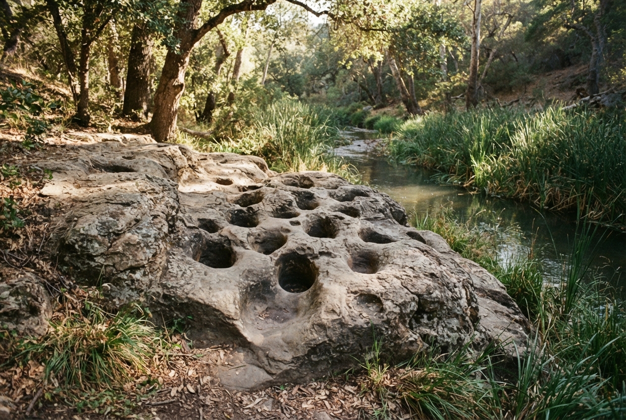
By the time Europeans arrived, the country from the coast to the Santa Lucia Range was the home of the northern Chumash, the people the missionaries would call Obispeño. They lived in villages along the creeks, and the name Nipomo, "at the foot of the hills," is theirs. Along Los Berros Creek the essentials were all in reach: fresh water, tule for houses and boats, acorns from the live oaks on the slopes, seeds from the grassland, and a day's walk to the estuary and the sea. Bedrock mortars, the holes worn into sandstone by generations of acorn grinding, are the quiet signature this era left on the land.
Mission, rancho and a name
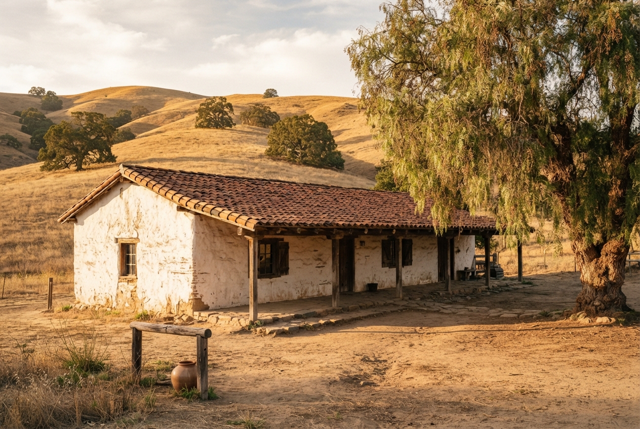
Mission San Luis Obispo de Tolosa was founded in 1772, and within a generation the Chumash of this valley had been drawn into its orbit. After Mexico secularized the missions, the land was granted out as ranchos. In 1837 Rancho Nipomo, roughly 38,000 acres running from the mesa to the hills, went to William Goodwin Dana, a Boston sea captain who had married Maria Josefa Carrillo and taken Mexican citizenship. The Danas built their adobe on the rancho in 1839; it still stands in Nipomo, the oldest house in the county that is open to the public.
Somewhere in these years the creek got its name. Watercress grows in cold, clean, running water, and the Spanish speakers who rode this valley called the creek for what they found in it: los berros. An 1883 county history illustrated the "Los Berros ranch and residence" of W. C. Dana, one of the captain's sons, which suggests that by then the valley was a working ranch in its own right.
The narrow gauge and the stone
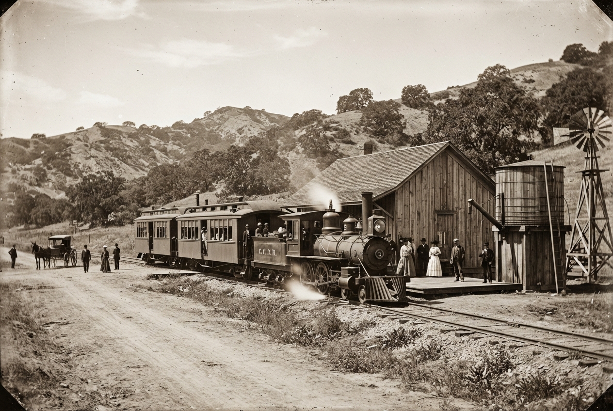
The Pacific Coast Railway changed the valley's rhythm. It began in 1873 as a horse tramway from the wharf at Port Harford, became a three-foot narrow-gauge steam line in 1875, reached Arroyo Grande in 1881 and Santa Maria in 1882, and pushed on to Los Olivos in 1887. Its route south from Arroyo Grande climbed through the Los Berros valley, and the timetables list a stop simply called Berros, thirty miles out from San Luis Obispo. Maria Josefa Dana, by then a widow, granted the railway a right of way across Rancho Nipomo in exchange for free rides for the rest of her life.
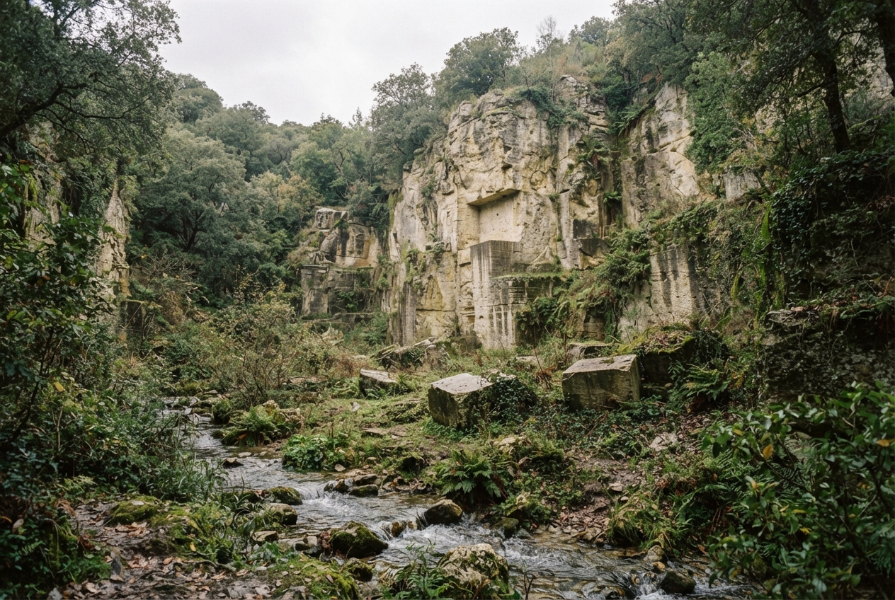
The railroad made it worth quarrying the valley's stone. On the south side of Los Berros Creek the Moore quarry cut a volcanic tuff in two layers; the state mineralogist noted that the lower one "has a metallic ring, and breaks in small blocks with curved faces like glass." Businessmen from Los Angeles leased it as the Los Berros Stone Company, ran a gang-saw mill down in the creek, and shipped building stone to Arroyo Grande, San Luis Obispo and, by way of Port Harford, to Los Angeles. The quarry was working in 1906. By 1915 the state's inspectors found it "idle for years" with the equipment gone.
The railway itself faded through the 1930s, its branches dismantled, and the last of it ended around 1941. The grade still shows here and there as a level line along the hills.
Fields
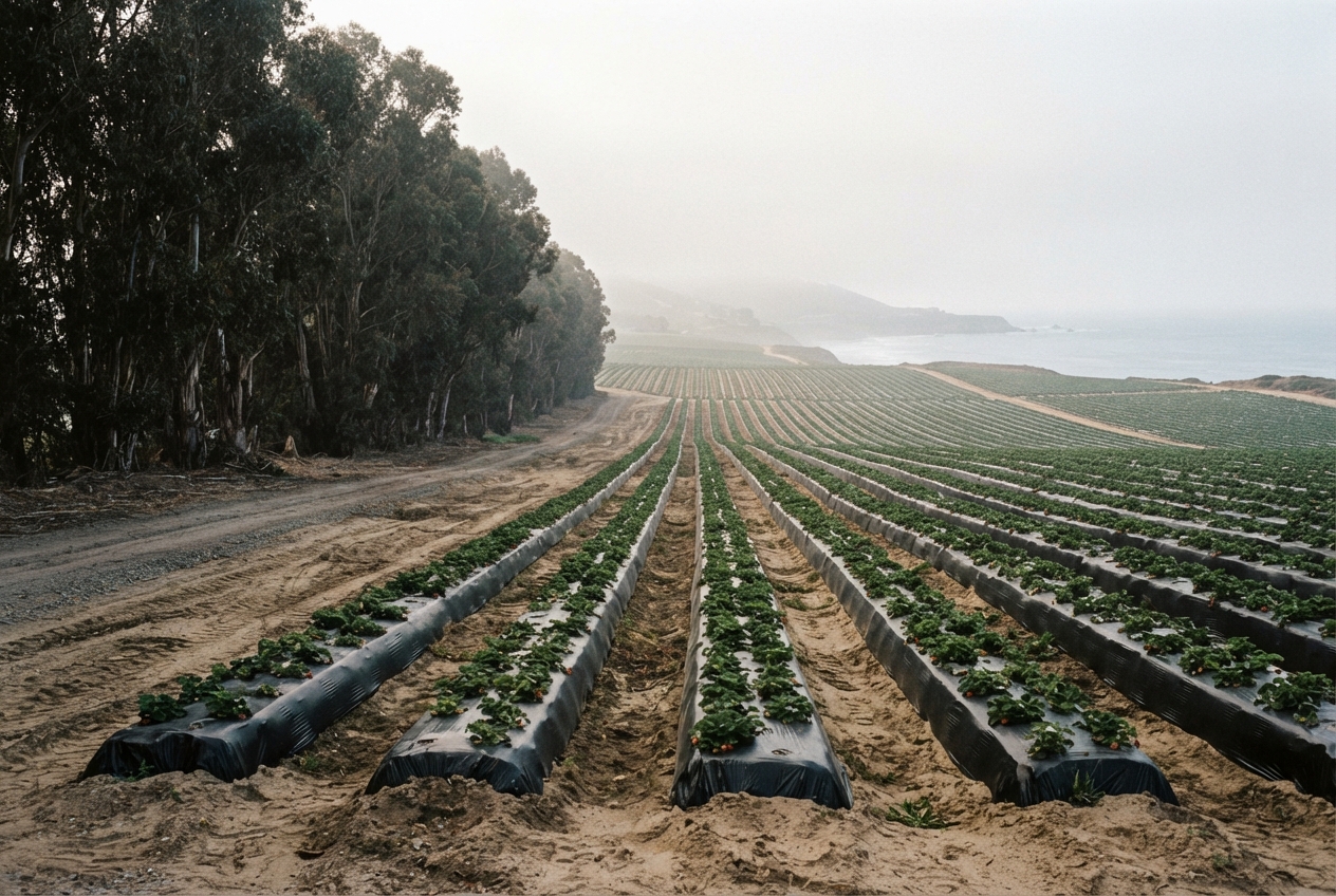
With a station and a road, the valley and the mesa above it turned to farming. Growers around Nipomo tried crop after crop and shipped what worked out by rail. The work was done first by immigrants from Europe and China, and by the turn of the century largely by Japanese families, who stayed on the mesa as the main agricultural labor force until the war. Eucalyptus went in as windbreaks and stayed as landmarks. Today the sandy soils of the mesa grow strawberries and vegetables under plastic, and the valley floor is pasture, orchard and small holdings.
Today
Los Berros was counted as a place of its own for the first time in the 2010 census, with 641 people; the 2020 count was 623, on two and a half square miles, at an elevation of 194 feet. Children go to the Lucia Mar schools. The creek still runs, a gauge near Nipomo still measures it, and in a wet spring the watercress still comes up green in the clear reaches, which is as good a reason as any to keep the name.
Sources and further reading
- Jon M. Erlandson and others, "The Cross Creek Site (CA-SLO-1797) and Its Implications for New World Colonization," American Antiquity.
- Wayne W. Millis, Michael F. Rondeau and others, "A Fluted Point from Nipomo, San Luis Obispo County, California."
- Doug Jenzen, Nipomo and Los Berros (Images of America, Arcadia Publishing).
- California State Mining Bureau reports on the Moore and Caen quarries, 1906 and 1915-16, summarized at quarriesandbeyond.org.
- Pacific Coast Railway, route and timeline; Dana Adobe Nipomo Amigos.
- United States Census Bureau, Los Berros CDP, 2010 and 2020.